 |
| The dashed line are approximate-- its really hard to see trails from space. |
In 1917, Thomas Edison documented a voyage down the C&O, which is probably its best depiction:
My favorite line: "The many artistic old locks are tended by Veterans of the Civil War." Then, as now, the C&O was falling apart, and the Veteran's Affairs Department was hard at work finding employment for its charges. Interestingly, some of those same veterans may have helped destroy the canal in their earlier careers.
In 1917, it was still possible to navigate the C&O in its entirety from Cumberland, western Maryland, to the port of Georgetown, Washington, D.C. Edison operated a laboratory in Georgetown, so maybe the trip was just an excuse to check out some new camera equipment. Regardless, he was seeing the canal at the end of its life: for years, it had been operated at a loss by the Baltimore & Ohio Railroad, which acquired the canal to prevent it from falling into the hands of competing railroads. A flood in 1924 finally ended operation.
After the 1920s, nature reclaimed much of the C&O. Restoration has begun, but the point at which this journey starts is currently the second farthest southern navigable lock outside Georgetown itself. Here it begins, looking north:

At the entrance to Great Falls National Park is an old tavern, which opened in 1831 to cater to the C&O's travelers. Today its a visitor's center.
 |
| The Great Falls Tavern is visible on the right. |
Due to a low footbridge built over the canal, this the farthest southern navigable lock on the C&O. You can also see how closely spaced together they are, even for this relatively flat stretch of land:

 |
| Here you can see how the vertical rods were operated which controlled the flooding while the locks were closed: with great force. |

The workers who operated the locks lived in lock houses. Some have been restored to various levels of modernity; this one was left to ruin.

Every lock also has a secondary causeway used to prevent flooding when the gates are closed. On the C&O, they're pretty scenic.


From this point on, the water is too shallow for any traffic, and the canal becomes more of a stream.

Ahead, what looks like a bridge is actually a stop lock! This is a kind of lock used where the water level has a large variation, to prevent it from falling too low or flooding. On the towpath, before then, is a sign pointing to the Billy Goat Trail, where we turned.

Looking south from the towpath, you can see the Potomac river, Great Falls itself, and Virginia on the other side. Great Falls is the product of the "fall line," the point where a rocky geological region meets a softer geological region, resulting in a sudden drop that along the entire east coast.

There's not much I can say about Great Falls. It's just kind of epic.


 |
| Virginians added for scale. |

The Billy Goat Trail follows the north bank of the Potomac through some very rocky terrain. It makes for pretty fun climbing.


For a stretch after this point, the trail cuts through woods on its way back to the towpath.

 |
| Evidence for more recent waterway construction projects. |
At this point, the trail loops back and joins the canal, now heading north.

This section of the canal is unusually wide, and seems to have taken advantage of a natural feature rather than excavation.
 |
| A sluice gate on the side of the canal, a clue to how they made this section. |
 |
| A dam further down is another clue. |

One of the gate doors from this lock was blown off in a flood, and was submerged about half a mile downstream, so its going to be a while before this one is operational again. Perhaps they couldn't put the stop lock down in time.
 |
| Another lock house. |
And ahead, the stop lock! This time from the other side.

 |
| You can see here how the gate descends from the housing above. Perfect for preventing the canal from draining, preventing floods, or guillotining boats which refuse your toll. |

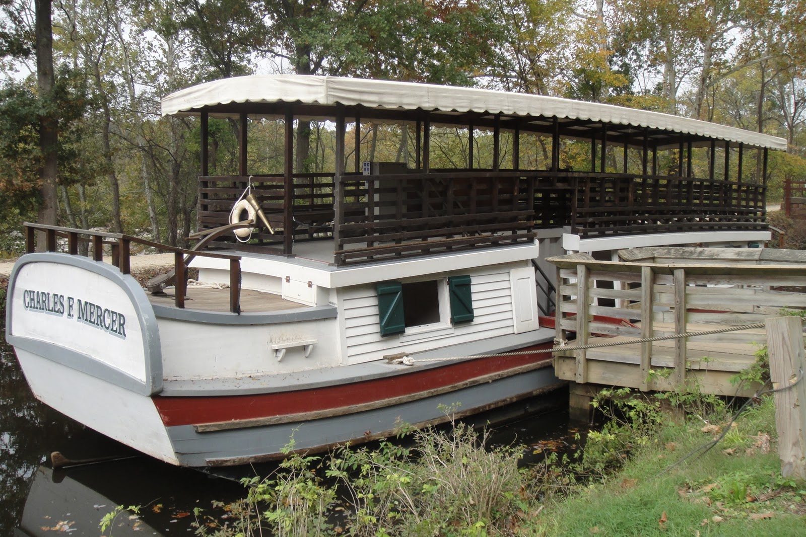
I'll admit, they do a good job. Compare for yourself:
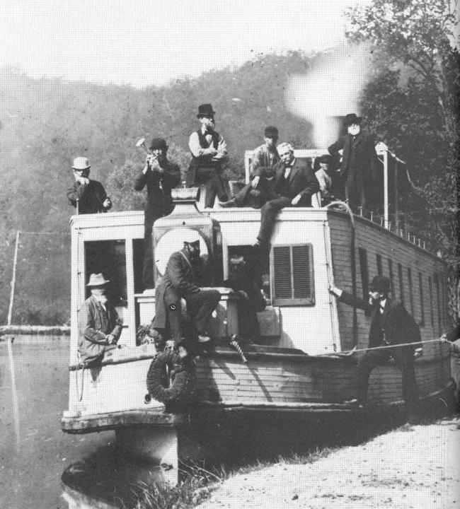 |
| A fine collection of hats. "Men boarding canal boat," courtesy the National Park Service. |
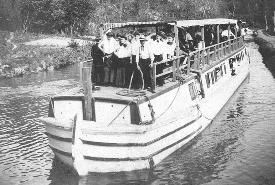 |
| "Packet (Passenger) Boat operating on the C&O Canal," courtesy the National Park Service. |
This walk represents only a truly tiny portion of the C&O, and there's a lot left to explore, both urban and hinterland. I hope to do both, soon.
No comments:
Post a Comment