
This is also a map of the town of Canterbury. You can see the large cathedral at center, and for some distance my path followed the defensive wall which enclosed the medieval settlement and can be made out circling around the top.
Canterbury is old: the wall itself was built on a Roman one, and takes advantage of a tall Roman mound. Just off the south of the map, the walls of a Norman castle still stand, and the cathedral has a list of deans in it going back to the ninth century. Even the graffiti is dated:
 |
| See previous posts for other things made in 1667. |
 |
| From the countryside. |
The park reminded me of Rock Creek Park, and in general I've been struck the continuity of the biome between England and mid-Atlantic America. Especially the effect on my allergies.


Everywhere, the river is full of these great water plants, which might have been more noticeable because the water level was at its lowest due to a British drought.

Then the Riverside Walk enters Canterbury, the point at which it appears to begin running along the old defensive works of the city. Whether it was built as a moat, or whether the walls simply took advantage of a natural waterway is unclear. Like everything here, there are layers of construction and reconstruction, and the medieval English were relentless terraformers.


The remains of the wall become more apparent as we approach the West Gate, the place where the main road running through Canterbury crosses the water.


The weather was fantastic, and all over the park people were paralyzed by the sun, next to the water. The West Gate looms.


Just south of the West Gate, boats were available for punting. But they barely cleared some of the bridges even with this low water level, it looked like there would be about six inches clearance when the water was higher.

Here's the West Gate from the main road, St. Dunstan's Street. Once through the gate, traffic is directed south, and St. Dunstan's is closed to cars.

North of the West Gate, there's an interesting blend of medieval, industrial, and modern buildings, all sharing the same space.
 |
| This is beginning to look more like canals I'm used to. |
There was clearly some industry located along the water here at some point, although what type, I'm not sure. Whatever it was, it probably harnessed hydro power:

The bridge ahead was actually built by an enterprising restaurant as its entrance.

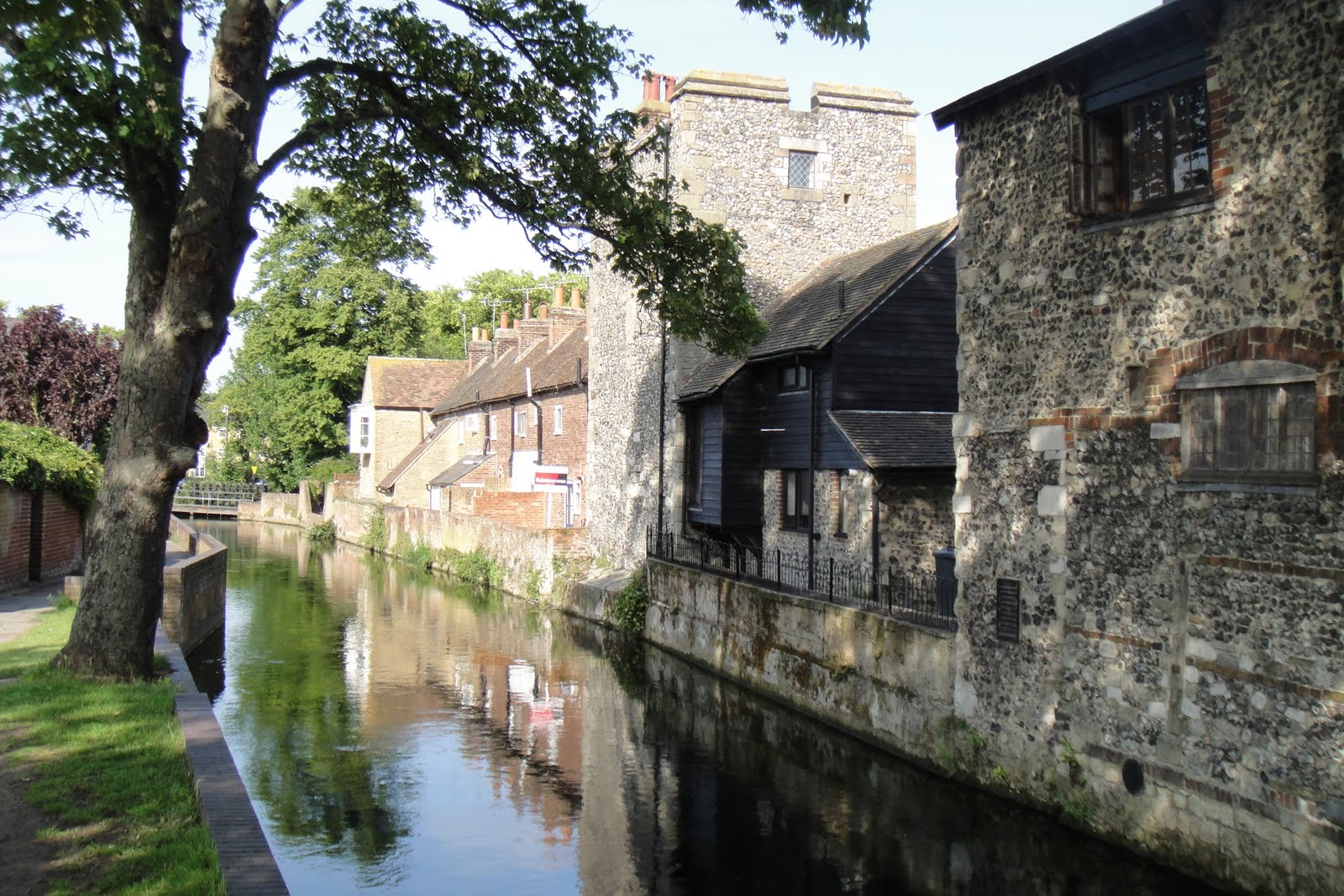 |
| I think late medieval, early industrial, and post-war are all visible in this picture. |
A few minutes after this, a man leaned over his back wall from the last house on the right, caught a decent sized fished, and took it inside for dinner. Now that's convenience.


After this, the walk turns east, and the river branches and branches again. I followed one of the branches east and then south to a park where it doubles back through the town.
It was clearly very industrial at one point, but now only the foundations and the locks / gates remained.


 |
| The date on the bridge read 1829. |
Another set of amazing backyards lined the river opposite the park:

Looking south, the river continued through Canterbury, but the park came to an end.

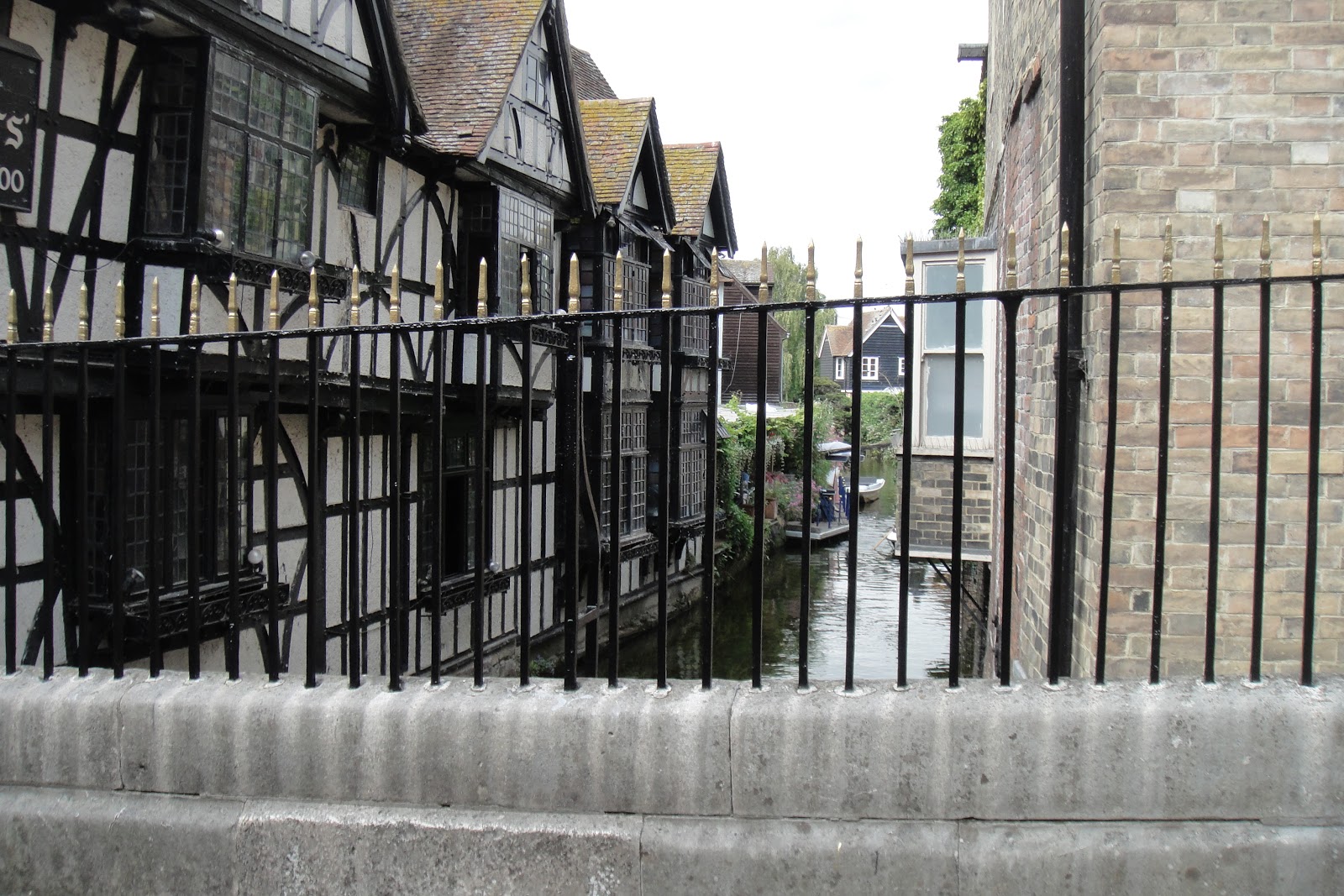
According to someone who went by on a boat a few minutes, this building belonged to the Black (or Dominican) Friars. Ecclesiastical orders have a long history here, but were broken up by a succession of English kings, ending with Henry VIII, who cleverly evicted them by requisitioning the lead of their roofs due to a shortage. Around the Cathedral itself, you can't throw a stone without hitting the ruins of a former monastic structure, although I really don't recommend trying this.

This is the point at which the river doubles back under St. Dunstan's Street.

This was the shortest route I've followed yet, but likely the prettiest and most relaxed. I'll be on the lookout for more like it, wherever that may be.

No comments:
Post a Comment